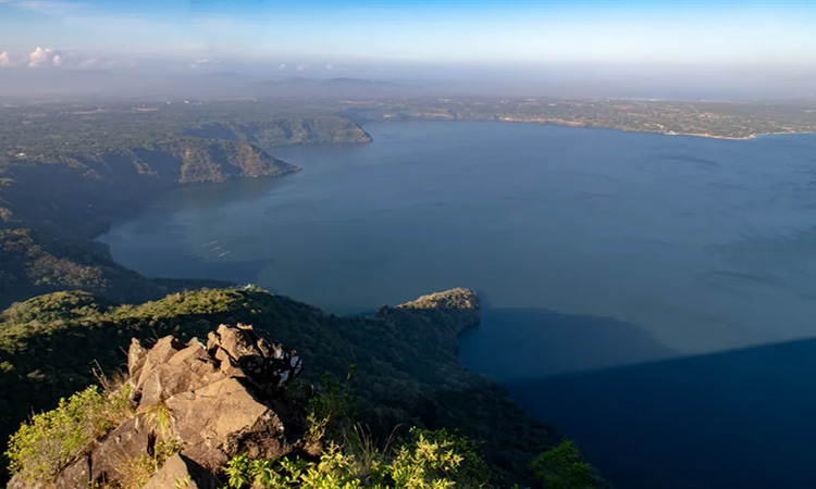
The Philippines is a collection of 7,107 islands and known for its abundant and glorious beaches. The country is home to natural wonders including the 3,142 majestic mountains that stand in their own beautiful ways.
Make your own adventure-filled days and challenge your limits. We challenge you to be a conqueror, not only to your fears, but also to these 10 Best Mountains to Hike in the Philippines.
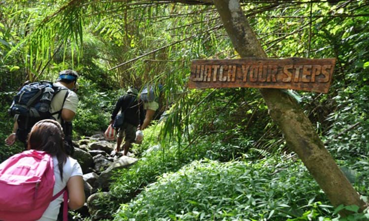
One of the country’s pride being the highest peak standing at 2,956 meters above sea level located at Davao City is the grandfather of the Philippine mountains. Mt. Apo is one of the most challenging mountains to hike in the Philippines; it would need proper conditioning, determination, and most importantly, loads of energy. It could take approximately 10 hours, or 2-3 days, to reach the summit.
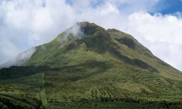
Mt. Apo is a dormant volcano that has a total of seven peaks. There are four trails which you can choose from. You’ll find the crystal clear waters of Lake Venado at the crater. Get ready to embark the steep trails, mossy swamps, jagged rocks, cliffs, thick forests, and volcanic structures.
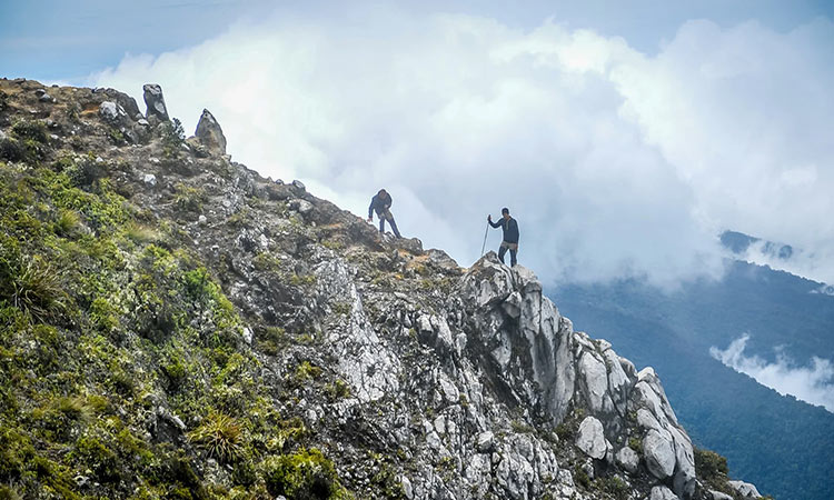
Upon arrival at the summit, the panoramic views of almost the entire Mindanao will welcome you. Spend unforgettable minutes of your life watching the sunrise on top of the highest peak in the country. Definitely, a sweet reward!
Mt. Pinatubo, tucked in the province of Zambales, has secured its spot on the top of the hiking destinations in the Philippines list. It is the most powerful active stratovolcano with a record of the second largest eruption in the 20th century. Its peak stood at 1,745 meters above sea level (MASL). Now, it is currently standing at 1,486 MASL, and considered as a minor climb.
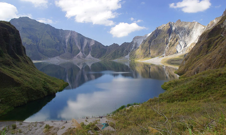
To reach the summit, you have to hop into a 4x4 for a 45 minutes ride to the foot of the mountain, and get ready for a two-hour hike. While walking through the trail, you’ll pass through volcanic formations, streams, cliffs, lush forestry, and remnants before the eruption. Today, the once ruined backdrop of Mt. Pinatubo is peaceful.
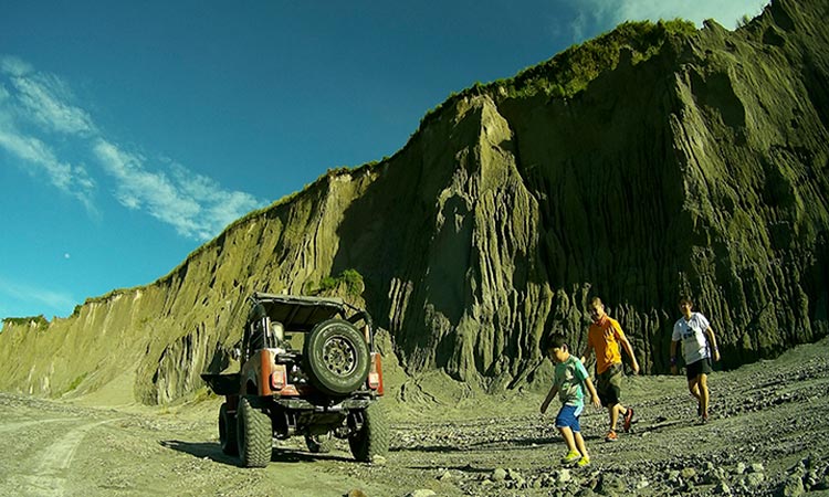
The breathtaking turquoise lake in the crater, surrounded by drop-dead gorgeous rock formations, is a sight to behold. The tragic past has turned into a majestic present. Mt. Pinatubo was a disaster that people will always seek-after.
Meet me where the sea of clouds touches the ground. And maybe you’ll wonder where in the Philippines is that? Head out to Benguet where the highest peak in Luzon, and the third highest mountain in the country, nestles. It stands at 2,922 MASL, and it would take approximately 4-5 hours to reach the summit.

The hike to Mt. Pulag has a difficulty level of 4/9, and the cold weather greatly adds up. The temperature in the mountain could drop to as low as -2 degrees, so bring your thickest clothing out of the closet. Mt. Pulag has four trails, and the easiest and most popular is Ambangeg Trail. Ambaguio is the opposing trail, the longest and hardest trail. You’ll walk through a range of vegetation, open grasslands, and extensive forests full of abundant greenery.
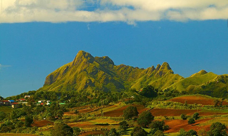
People refer to Mt. Pulag as “Playground of the gods”. Aside from the experience of walking through the clouds, you’ll also enjoy a 360-degree view of the Cordillera. At night, you’ll get a perfect view of the mesmerizing sky.
Considered as one of the most photogenic mountains to hike in the Philippines, Mt. Ulap in Benguet is a sought after destination for hikers. It has a height of 1,846 MASL, with a difficulty level of 3/9. One would take approximately 3-4 hours to reach the mountain's summit.
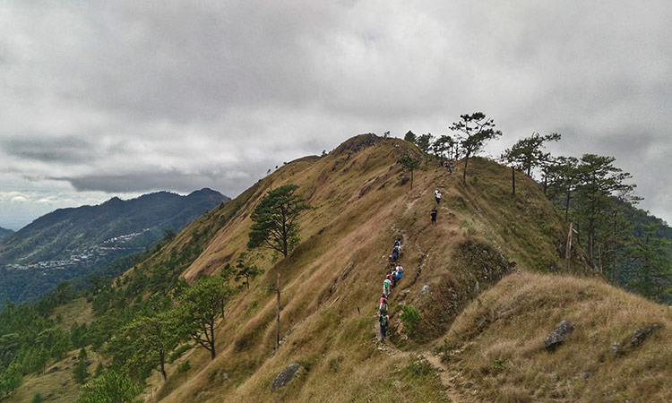
The mountain has three peaks namely Ambanao Paoay, Gungal Rock, and the summit. Among the three, the most famous spot is the Gungal Rock Formation for its impressive view that screams ‘perfect spot’ for taking pictures. If you prefer to experience a cloudy trail, the months of September to December are your best options. It is indeed a heaven-on-earth type of experience!
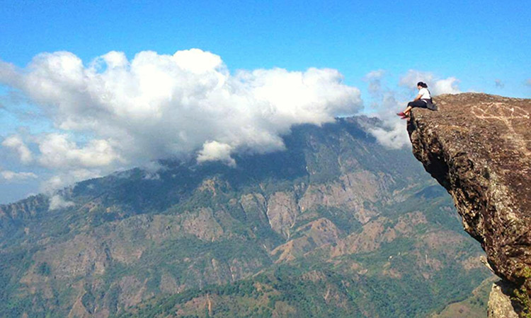
Living up to its name which translates to clouds, you’ll get to witness the clouds kiss the mountain’s summit. Aside from the sea of clouds, savor the landscape of Cordillera mountain range, pine trees, hanging bridges, hills, and grasslands.
At the heart of Sierra Madre mountain range sits one of the most visited mountains to hike in the Philippines named Mt. Daraitan. It stands at 739 MASL, and considered to be a minor climb but with a difficulty level of 4/9. It would take approximately 3-4 hours to reach the summit.
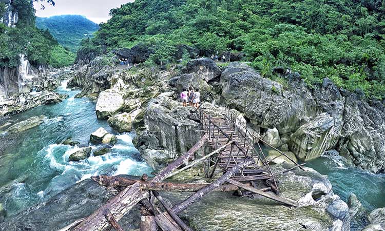
Above all, exercise caution in hiking Mt. Daraitan because of its intimidating nature. We don’t want to go home with a scraped knee. The climb is a straightforward 600-meter ascent. Yes, just to think of it feels exhausting already. A rewarding backdrop of limestone formations, rivers, caves, and scenic view of Sierra Madre mountain range awaits.
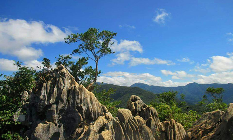
A side trip to Tinipak River would complete your Mt. Daraitan experience. After a tiring hike, you deserve to lay eyes on this piece of paradise.
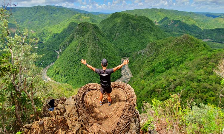
Popular for its myth of Maria Makiling, Mt. Makiling is an inactive volcano with a difficulty level of 5/9. With an elevation of 1,090 MASL, the mountain sits beautifully at Laguna.

It is a dwelling place for various species of flora and fauna, and endemic species. Mt. Makiling’s traverse begins in Sto. Tomas, Batangas and ends at Los Baños, Laguna. The trail leads hikers to preserved forests where you’ll probably bump into some wildlife. The trails has narrow parts, a mossy section, and the most challenging is the steep ascent. Oh, and look out for those blood-sucking leeches that you might encounter along the way.
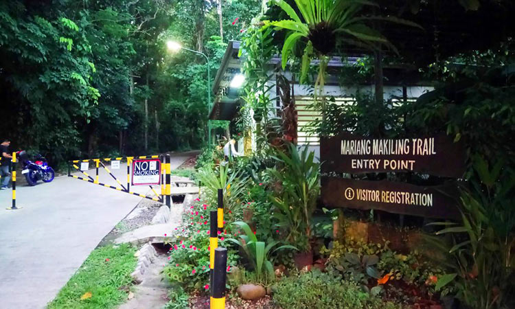
To reach the summit of this enchanted mountain would take approximately 5-7 hours. From the peak, a spectacular view of Southern Tagalog mountains will ease your exhaustion from the climb.
A gem in the province of Batangas, Mt. Maculot is accessible to many, and is a well-known day hike destination. Mt. Maculot summit stands at 930 MASL, which would take hikers approximately 4 hours to reach. It has a difficulty level of 4/9.
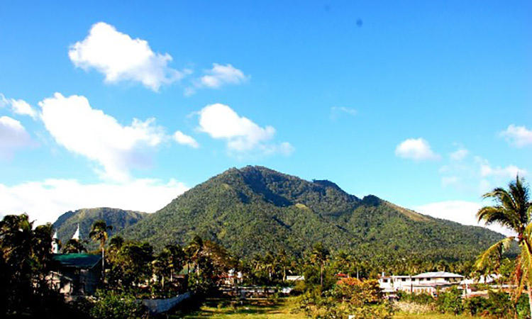
There are three destinations in Mt. Maculot, namely the Rockies, Summit, and Grotto. You could go for a traverse and reach the three destinations in one hike. The trail has steep and dusty parts. Upon reaching the Grotto, the Shrine of Our Lady of Lourdes would welcome you. This makes the mountain well-known to devotees especially during Holy Week.
Once you reach the top, you’ll get a glorious view of Taal Lake. Perfect backdrop for a photo! (Or should we say photos? We bet you’ll never get enough of it!)
Mt. Halcon is one of the toughest mountains to hike in the Philippines. Standing at 2,582 MASL in Oriental Mindoro, it is a major climb with a 9/9 difficulty level. It would take 3.5-4 days (approximately 15-18 hours) to set foot on the summit.
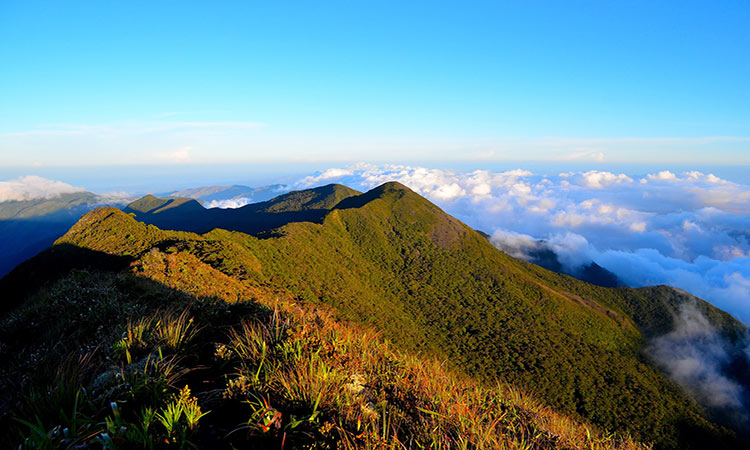
The mountain is a sanctuary to diverse endemic flora and fauna. The long and steep ascents of the trail would make you want to give up and just go back home to snuggle in bed. But let's not put your effort to waste. So, recharge as you walk through the waterfalls, rocky ridges, dense forest, and river crossing.
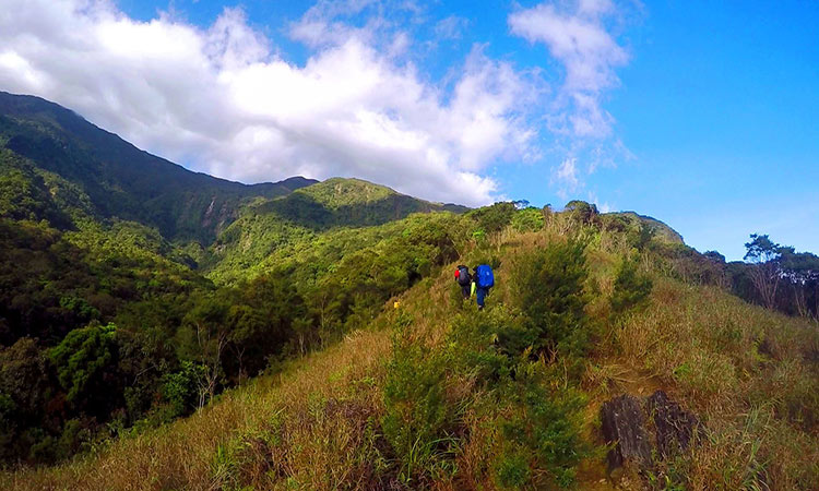
It is recommendable to hike Mt. Halcon during the months of March to May for a greater chance of succeeding the climb. It would require preparation and planning for a safe and successful climb before you get the reward of standing at the sacred summit of Mt. Halcon.
Famous for its iconic cone shape, Mt. Mayon is one of the two mountains in the world that are perfectly symmetrical. Its charm will captivate you. But because it is still an active volcano, you better watch out. Make sure to check first with the Department of Tourism Office and PHILVOCS. You wouldn’t want to deal with a raging volcano, would you?
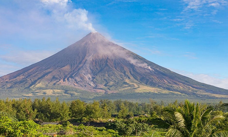
Mt. Mayon is a gem in the province of Albay, and stands at 2,363 MASL. It is a challenging hike that would take 2-3 days to climb until the summit. The authorities prohibits to go through the summit due to the volcano's activity. On the bright side, you could still hike until Camp 2 which takes approximately 2-3 hours. You’ll pass through grasslands, rivers, gullies, and traces from its previous eruptions.
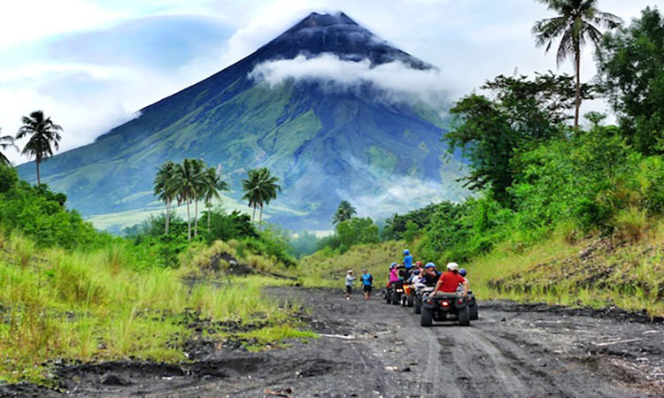
The main highlight of the adventure would be indulging yourself with nature at its finest.
Magnificent yet fearsome ‒the perfect way to describe Mt. Kanlaon. It nestles at Negros Occidental, known as the highest peak in Central Visayas, and the largest active volcano in the Philippines. It is a major climb with a difficulty level of 8/9, and would take 3-4 days (15-16 hours) to reach the summit.
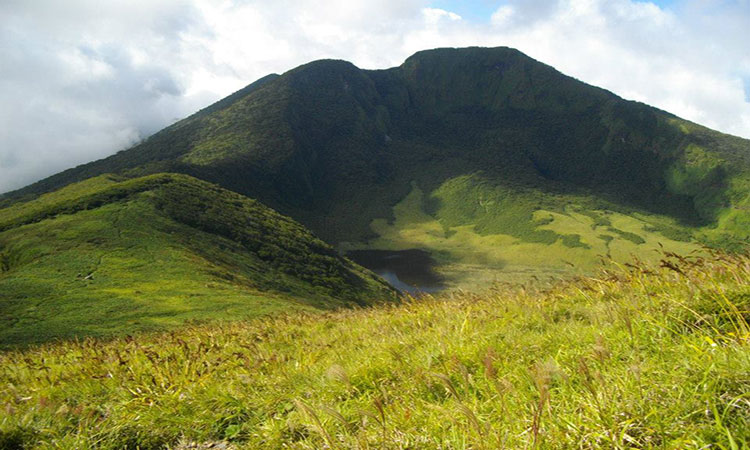
Mt. Kanlaon is the country’s third most active volcano, so don't forget to coordinate with DENR before proceeding to climb the mountain. The mountain’s trail is steep, lengthy, and demanding. You’ll walk through vegetation zones, thick rainforest, rolling hills, waterfalls, and lagoons.
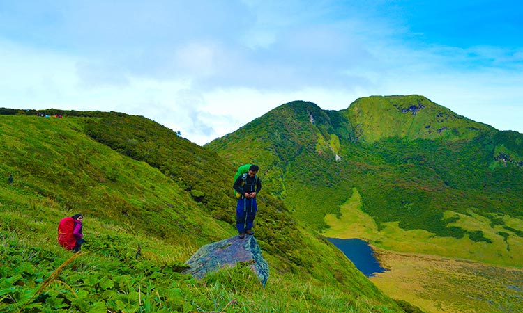
We know that the view from every summit would be refreshing and pleasing to the eyes. Mt. Kanlaon is different, because you'll experience both fascination and fear (because it might erupt without a warning). Thrill-seeking adventurers, this one’s for you!
Do you already feel the adrenaline rush? Let the adventure spirit in you unleash and start planning your epic hiking trips! For more escapades, check out the must-visit destinations in Davao, or if you're a first timer in the country, we have a travel guide for you.

Get our recommendations, tips, and exclusive content before anyone else in your email box.